

|
|
Thursday August 16th 2012 looked to be an exciting day for weather action across N. Ireland due to a moist unstable SWly flow with 1000 CAPE and LIs of -3. All the convective forecasters were going for organised thunderstorms due sufficient wind sheer and with suitable veering winds a supercell and tornado were possible if storms could get going. By late morning things had kicked off with heavy convective showers growing rapidly on radar near Cookstown which then moved N along the W flank of Lough Neagh, they would then sail across the majestic Sperrins producing copious precipitation. The sky was overcast so I was concerned this could hinder convection however by early afternoon the atmosphere simply exploded. By 13.00 the sky was clear with strong solar heating and in no time I could see quite impressive convection going up for so early in the day with large anvils already spreading across the sky so I knew this had the potential to be a remarkable day as there appeared to be no cap at all to impede convection, in this kind of set up things can and do happen fast so I was ready to get on the road much earlier than expected.
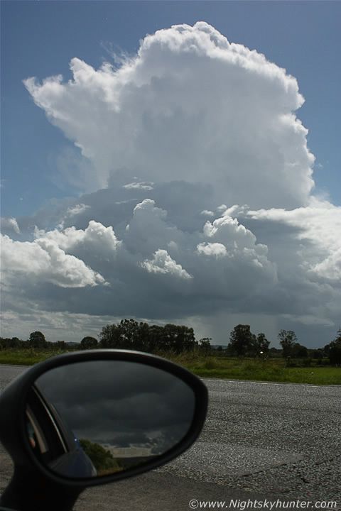 |
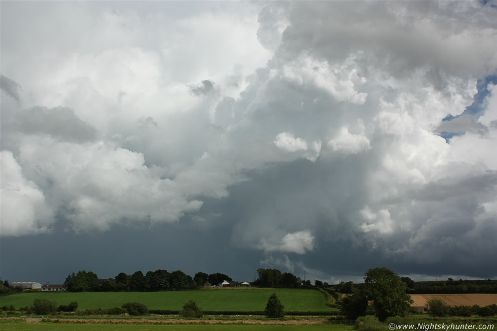
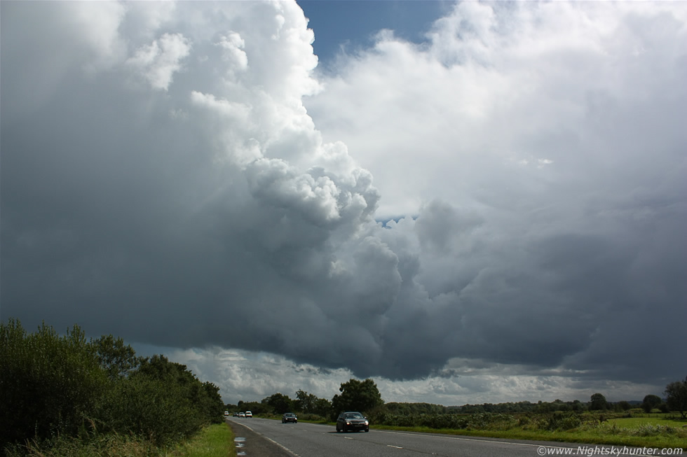
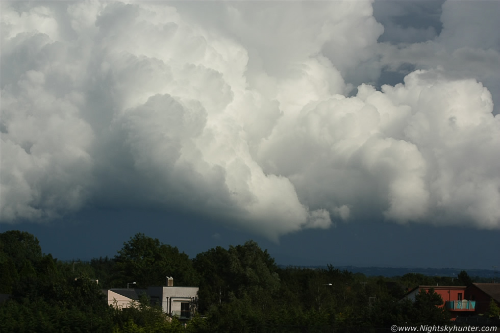
I left Maghera and headed S to meet the cells that where heading my way and with a slack flow at lower levels I knew any storms which did form would be slow moving and hence much easier to chase, in fact, my favourite chasing conditions are these slack Sly flows associated with the post frontal environment behind Summer low pressure systems and their associated frontal systems. Slow moving storms can be a problem for those who don't like bad weather or have to work outdoors as heavy rainfall tends to stay in a particular area for a longer period of time which often leads to flooding and dangerous driving conditions however to a photographer slack is like heaven as these slow movers allow you to stay within visual range and watch as any cell develops revealing its full life cycle and drastically increasing the odds of transiting into a very photogenic stage. As I drove along the Glenshane Road convection looked so good that I simply didn't want to waste anymore time so I pulled off the main road onto the E side and drove along the narrow hard shoulder over crunching dirt and gravel until I found a spot which offered a good view away from clusters of trees. The above image shows the rapid birth of a big storm with its towering updraught starting to anvil out along the troposphere as its cauliflower tops boiled in the hot afternoon sun. This was facing S and the cell was slowly moving towards me so I had the joy of watching it evolve in full view, I had a feeling it was going to do something good because it was still over 10 miles away and there was nothing to stop it growing in this very unstable air.
 |
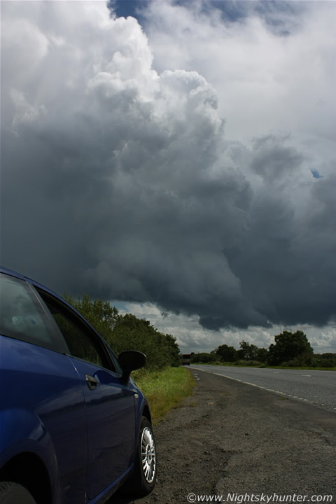
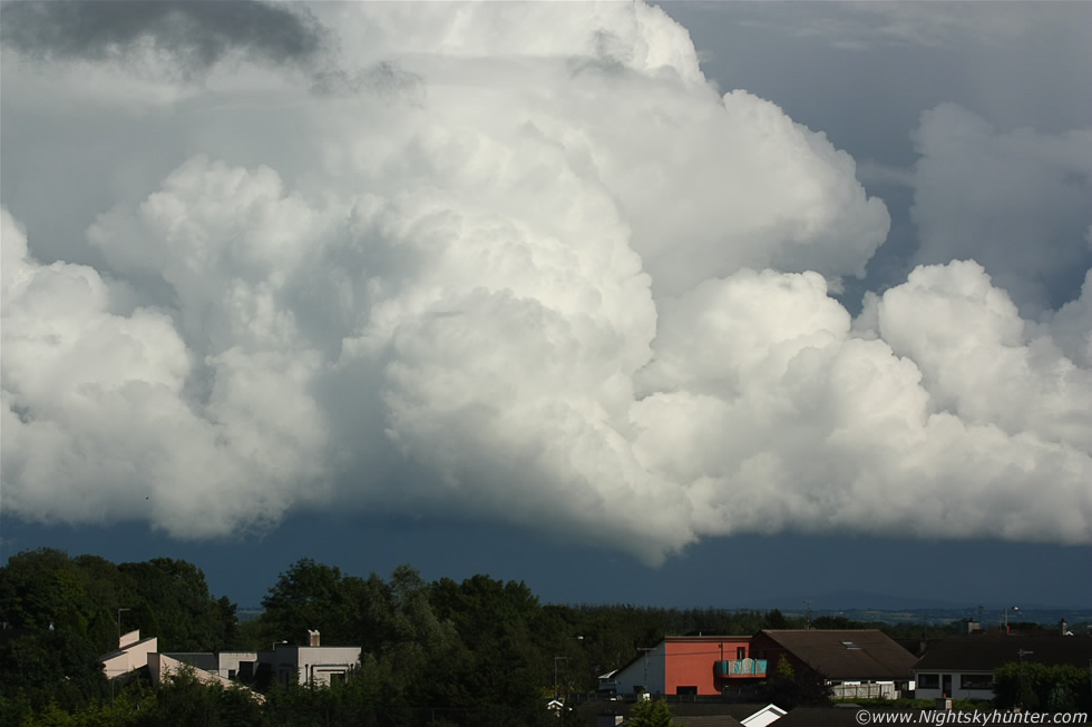
A little later and getting closer with the anvil growing, I didn't know it then but this was the genesis of the second severe thunderstorm which would move across Co. Antrim this day and at this moment it was just beginning to show up on radar, moving R to L in the image. I got a text from storm chaser Paul Martin in Omagh reporting several rumbles of thunder near town and saying he could see a massive sheared anvil in my direction so this must have been the same one Paul was observing. I was so fixated on this growing cell that I forgot to look around and that was when I heard a distant rumble of thunder behind me to the E so I glanced in that direction through the passenger window and let out a line of vernacular which I won't repeat here.
 |
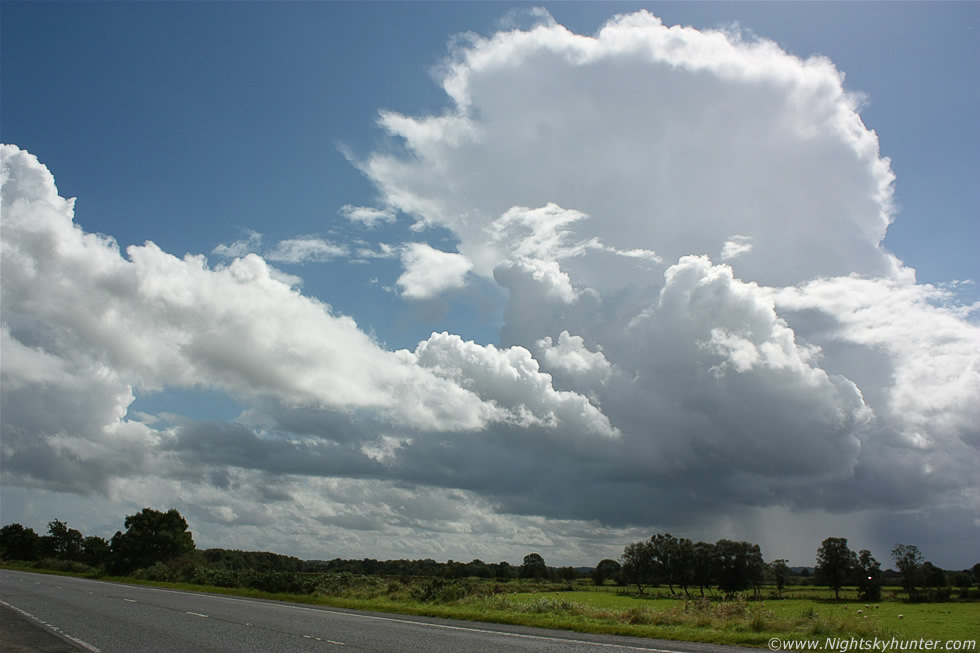
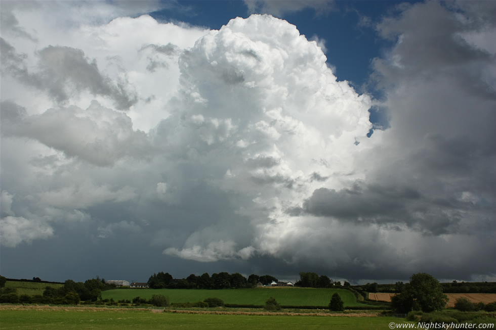
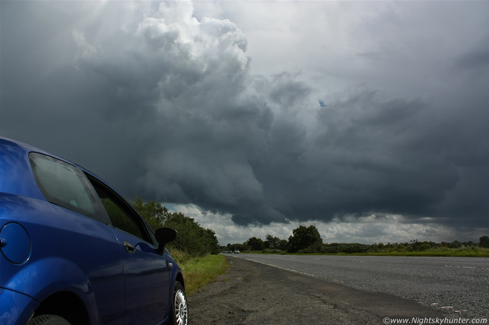
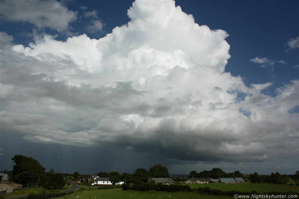
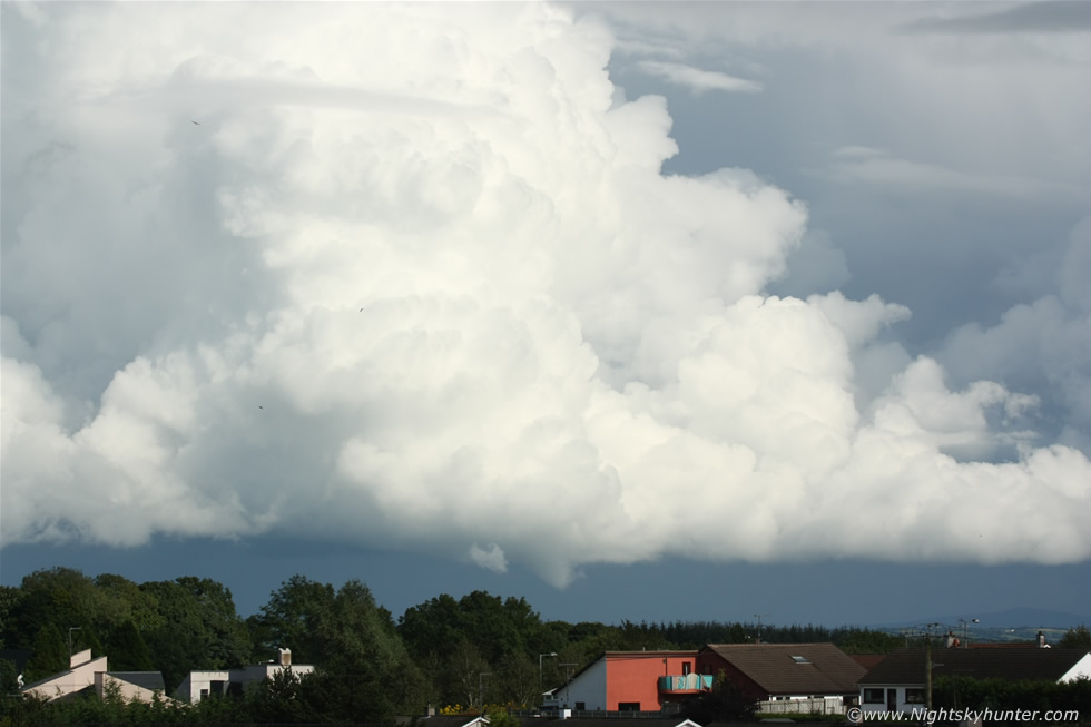
This was the view E towards a big thunderstorm which had grown from nothing to a beast within a short period of time, at this stage it was moving over the N sector of Lough Neagh and heading over Antrim and despite being miles away I could hear the thunder booming at regular intervals as it moved away from me to the NE. The images which follow don't do this scene justice at all, this was an extremely well organised thunderstorm of huge size and visually it looked astonishing lit brilliant white in full sunshine with a clear blue sky contrasting with the storm clouds with the lush fields below which made for a very pleasing experience and photo opportunity. I ventured down this narrow tractor lane between fields and began taking images. This was the flanking region of the storm, moving R to L, with big anvil and explosive updraughts the likes of which I hadn't seen in years.
 |
The structure on this storm was extremely interesting with a sheared anvil blowing downrange away from me to the N and precipitation core leaning well forward from the main updraught indicating an organised mechanism and the new updraughts were explosive. I have used this term before to describe bubbling updraughts which were impressive in their own rite but never before had I seen explosive convection quite like this, the updraught height and structure with rock hard bubbles were boiling by the second like a real life time lapse video like a storm from the USA, when I observed the towers carefully it almost seemed as if the storm itself was alive and breathing. The striation-like grooves and bulges along the wall of the new updraught and the swollen base below it indicated the presence of a possible rotating updraught so this storm could well have had supercell characteristics, after all they were forecast for N. Ireland.
 |
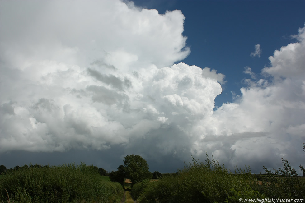
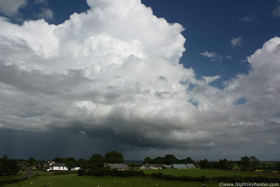
Mid level cloud ahead of the other cell behind me was starting to move in and block some of the structure so I had to wait for gaps to get images and video footage. This image shows nice structure in the updraught and flanking region with a good low base which I watched carefully for funnels and tornadoes, this was a beast of a cell and I had to admit to feeling shocked at the caliber of what I was seeing for so early in the afternoon.
 |
I got a lucky break in the blowing clouds for a wide structure shot, the updraught at this point was simply epic like the ejecta plume from a volcanic eruption, I was quite awestruck by the height of it and by its sublime back-building nature as more thunder rumbled across the fields, what a beautiful storm this was!
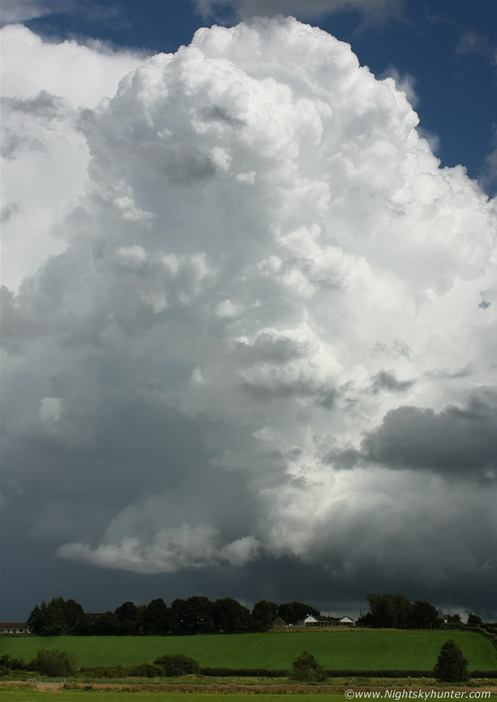 |
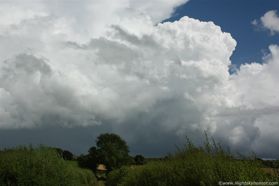
Probably among the most explosive of updraughts I have been lucky enough to witness in recent years and all lit in convective beauty by the bright sunshine. Check out the house to the lower left and imagine the size of a person using the windows for scale then compare that mental image with this massive updraught and you will feel the wow factor.
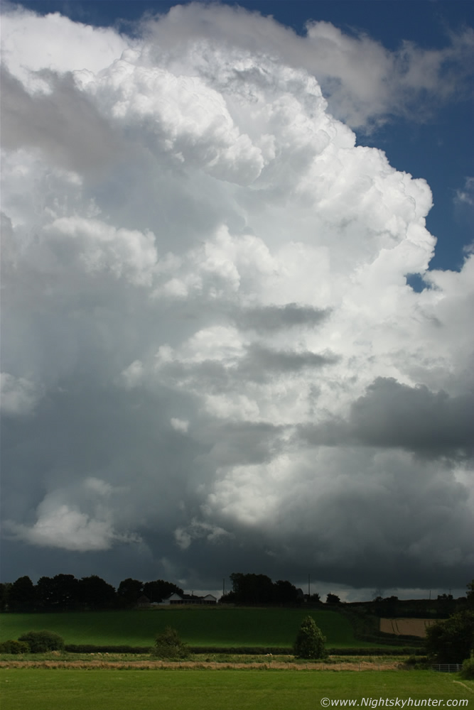 |
Check out the rain free base to the lower R and watch how the tower goes up and leans forward to the L towards the precip region which indicates the presence of strong vertical wind shear, that means the winds get stronger with height so the updraught is organised and can live longer and hence increasing the chances of severe weather, the cell is also back building so new updraughts are forming all the time.
 |
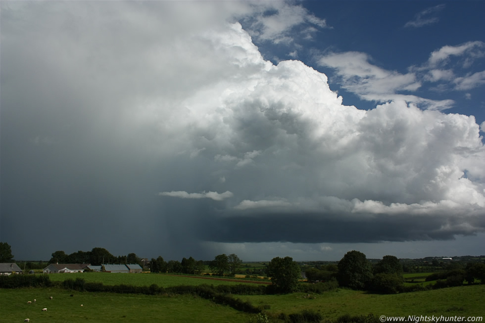
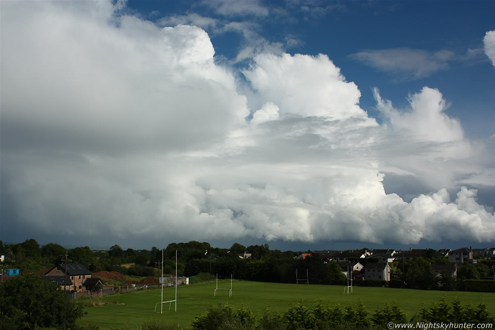
As the Antrim cell continued moving away from me carpet bombing the country with c-gs I turned my attention to the first cell I had been watching which was now maturing rapidly with stunning structure once again indicating a strong sheared cell. The size of this is difficult to describe however you will get an idea if you watch the video clip at the bottom of the page, the precip core was to my L and the flanking region straight in front of me crossing the busy road with fabulous hard updraughts, it was so large I couldn't get the back end of it into the 18mm lens in portrait configuration.
 |
I counted five huge towers in stair-step fashion feeding into the back of the sheared anvil which was directly overhead and spreading across the E sky. The cell wasn't producing thunder yet however the structure was fantastic, this flanking region was really talking.
 |
I love dramatic storm clouds, these were putting a smile on my face I can tell you, moving R to L, it was difficult to believe this was the same cell I had been watching when I had first pulled over not so long ago (first two images on this report) talk about a dramatic transition. The video clip shows this scene very well when I chased after the base and panned the camera up through the windscreen showing the full girth of the cell which yet again had a hint of supercell structure. I got close to the base near the Castledawson roundabout and pulled over into a lay by to watch the base which was very solid with great textured structure sporting a slight lowering, I have images of this however the view was ruined by several power lines. After another funnel watch the cell lost me as it moved over territory which was difficult to chase so I let it go and headed into Magherafelt to do a message.
 |
On the way back from Magherafelt I spotted the cell again moving over the E sector of Ulster and now sporting full-on multicell structure, I was able to drive along the road adjacent to it and stole the occasional glance at the anvil and towers as I headed back N again, I pulled onto the hard shoulder again for a proper look and took some video but decided that the cell was dying as the clouds now looked soft so I went back to Maghera where the sun was shining and got myself a well deserved coffee Latte and Turkish Delight while keeping an eye on the sky. I was about to call it a day when I looked to the E above the rooftops and saw the multicell I had watched on the way down and I immediately got a surge of adrenaline, the storm now looked awesome and was in serious form so I ignored the rest of my latte and drove through the town for a better view, once I got into the countryside I drove at speed towards the storm then pulled over half way down a steep hill in the countryside where my friends and I used to train years ago doing our 10 mile runs for martial arts (amazing memories!), the car could barely fit in the tiny lay by I found but it served its purpose.
I ran across the road to the other side with the camera gear and began shooting what was now a remarkable multicell storm, when I had seen it before it must have been in a weak transition stage but now it meant business. This was looking E towards Antrim and near the Portglenone area where the heavy precipitation core was causing a flash flood in the local river within min's. The storm was moving R to L here and looked fantastic over the countryside, this was the flanking line behind the storm's core with solid towers and a very large rain free base (RFB) which is the breeding ground for funnels and tornadoes, a good RFB is what every chaser wants to see. This storm blew me away because of the incredible electrical activity it was producing, I was hearing almost constant thunder for the entire time the cell was in range and I mean constant! - rumble...rumble..rumble...and some of the rumbles lasted for very long in duration indicating clusters of bolts at the same time. The last time I heard constant thunder like this was back in July 2007 min's before I saw my first big funnel cloud so I was on full alert. I didn't see a single bolt of lightning so they must have been hidden inside the rain and from higher up inside the body of the storm and freezing thunderheads above, these are called In-cloud bolts or I-Cs for short.
 |
Watching this storm back build was incredible, the central tower would eventually turn soft as it glaciated then a new updraught from the flanking region would move in to replace the old updraught and that process would continue in a perfect cycle and when that new tower went up it did so alarmingly, check out the transformation on the video clip. The multicell was now getting quite far away but I could still hear thunder going strong and I now could just about fit the entire structure into the wide angle frame.
 |
There really is no better feeling in the world than watching storms from the countryside with a good horizon and green fields and with the exception of the odd passing car and from the thunder itself the only sound was the grazing of the Sheep and the calls from a Horse in a field behind me. The sun was intense at this stage and the sweat was running down my face in rivers, I was glad I had a bottle of water with me. I got back in the car and chased the storm deep into the countryside NE of Maghera through narrow twisting roads until I was somewhere on the outskirts of Kilrea and with fuel restrictions I decided to stop and just enjoy the show at the end of a lane beside an old farm building as the storm continued to rumble and roar and new updraughts continued to explode up at the back, I had never seen such perfect conditions for severe thunderstorms in N. Ireland for a long time. This cell continued NE for tens of miles and affected parts of Coleraine and Portrush before leaving the N coast and continued producing lightning across the Atlantic and even over W Scotland!. I spent the rest of the afternoon until 18.00 on high ground looking over the Sperrins at huge backlit cells with towering thunderheads growing high in the evening sun with distant rumbles of thunder over the mountains and ahead of it was the anvil from another storm hitting the NW coast near Magilligan, talk about phenomenal cells and a satisfying day of chasing with severe thunderstorms and great structures.
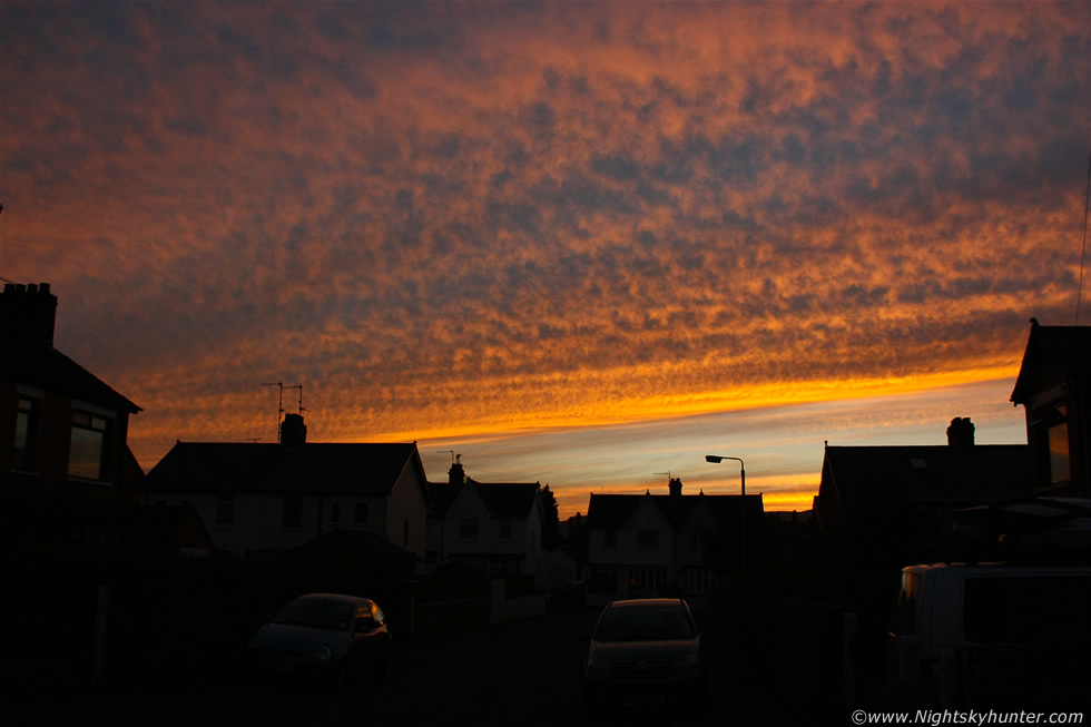 |
August 18th produced a beautiful sunset cloudscape over Belfast which I happened to spot by chance while doing one of my usual sky checks out the window. I called Roisin out to have a look and she was as impressed as I was so we walked out onto the road to get a few images, these mid level clouds had very complex texture and where spread across the entire W dome of the sky and extended to near the zenith with fiery gold, yellow, red, and blue colours. You can see the colours reflected in the windows and on the cars below, Roisin got a selection of very striking images using the camera on her smart phone.
 |
Tuesday August 21st turned out to be another spectacular day. I knew about the potential in advance from watching the models while in Belfast and as I got the bus home to Maghera that morning I couldn't wait to re-check the charts and get out with the camera. An unstable SWly flow again with 700 CAPE, LIs of -3, troughs, cool air aloft and vertical winder shear so all the ingredients where there. Skywarn UK issued a severe thunderstorm watch and TORRO issued a convective discussion and mentioned the possibility of rotating updraughts and tornadoes...
A TORRO CONVECTIVE DISCUSSION has been updated at 1410GMT on Tuesday August 21st 2012
THREATS
Wind gusts to 50mph; isolated tornadoes; hail; CG lightning
SYNOPSIS
Upper long wave trough moving across the British Isles, with a comma cloud feature evident on satellite imagery, associated with a smaller short-wave trough. Several lines of heavy showers and thunderstorms have developed across Eire and also N Wales, and will continue to move north-eastwards. Shear seems sufficient for these organised lines to continue. In addition, shear is marginally sufficient for updraught rotation. With a backed flow at the surface ahead of the line, one or two tornadoes are possible. Forecaster: RPK.
I was home by 12.00 and already things had kicked off in serious fashion in the form of a convective line which rapidly turned into a severe thunderstorm as it crossed N. Ireland, I counted 17 loud rumbles of thunder as it passed by to the S of Maghera then the line passed into Antrim where it intensified with red radar echoes, rotation was observed by a spotter in Randalstown then the line moved into E. Antrim where it developed into a LEWP with bowing segments just as it hit Belfast with torrential rain, gusty winds and thunder/lightning, I'm pretty sure it must have had a good shelf cloud on it when it arrived over the city. After the storm's passage the clouds cleared and the sun cooked the ground in the wake of the line and soon new developments came to life on radar, I really wanted to catch something cool this day however I was worried that severe storm might have been the event of the day but my concerns vanished with the latest radar update. Far away to my SW over Co. Tyrone was a new line forming with moderate precip cores stretching for tens of miles across the country, it was moving slowly to the NE so I anticipated it would arrive near Maghera in the afternoon and by then it could have a decent shelf cloud so I went out to an old favourite location outside of town on high ground in the countryside and waited.
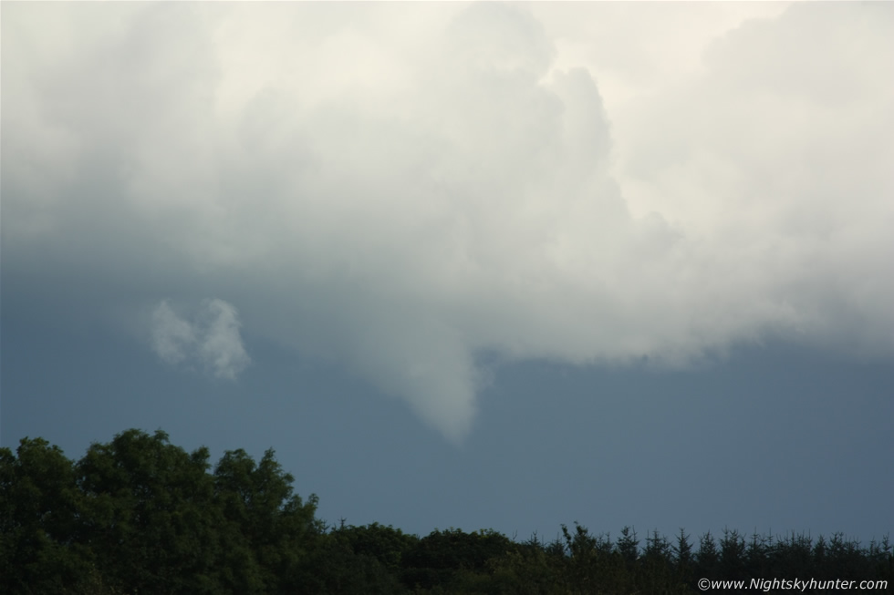
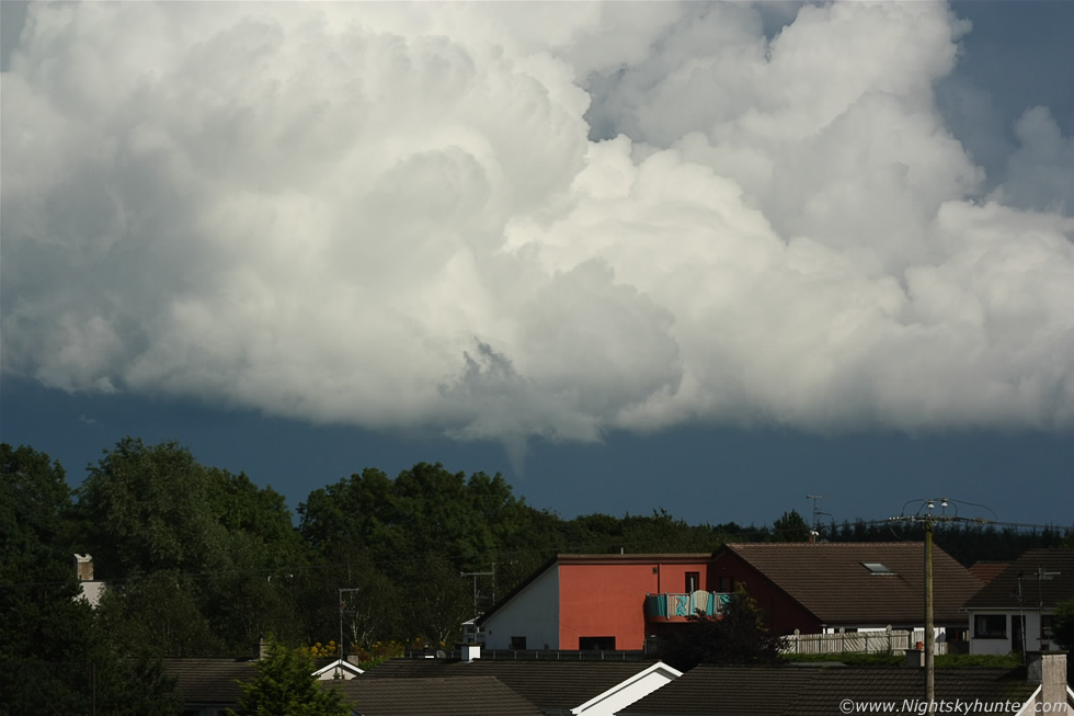
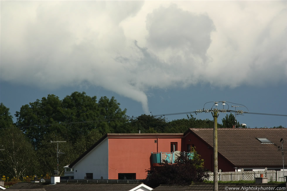
The line must have been very slow moving for I waited for one and a half hours before it hit my location and when it did I was disappointed as there was no great structure to speak of and certainly no shelf cloud other than heavy black clouds with several heavy precip cores, the S half moved over Maghera and the N section over the Sperrins and once it passed over me into the E heading for Antrim I began to get a very good feeling and unknown to me at this time the radar showed red echoes which backed up what my instincts were telling me. The sun broke out from the W and above me was the anvil from the line with mammatus so I hung around for a while incase there was a nice display. The visibility improved as the precip cleared then I could make out the forms of convection behind the line and I new in an instant that something was going to happen so I went back home and relocated to a spot near my house which gave me a decent view to the E. By 16.00 cells exploded to life along the flanking region of the storm with crisp towers starting to anvil and getting sheared as the sun cooked the ground, this was magic hour between 16.00 and 17.00 when things can suddenly happen. The above image shows that flanking region of towers with very low bases, to the far L where the tops of the severe line now over E. Antrim, once again you can see this flanking region on the video which shows the height very well. I knew by the appearance of the bases that a funnel cloud was very likely so I was ready and waiting and at approx 16.20 a funnel formed directly under the base of the middle tower!
 |
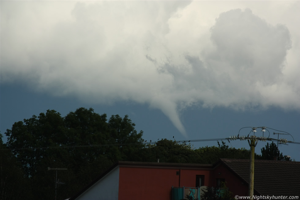
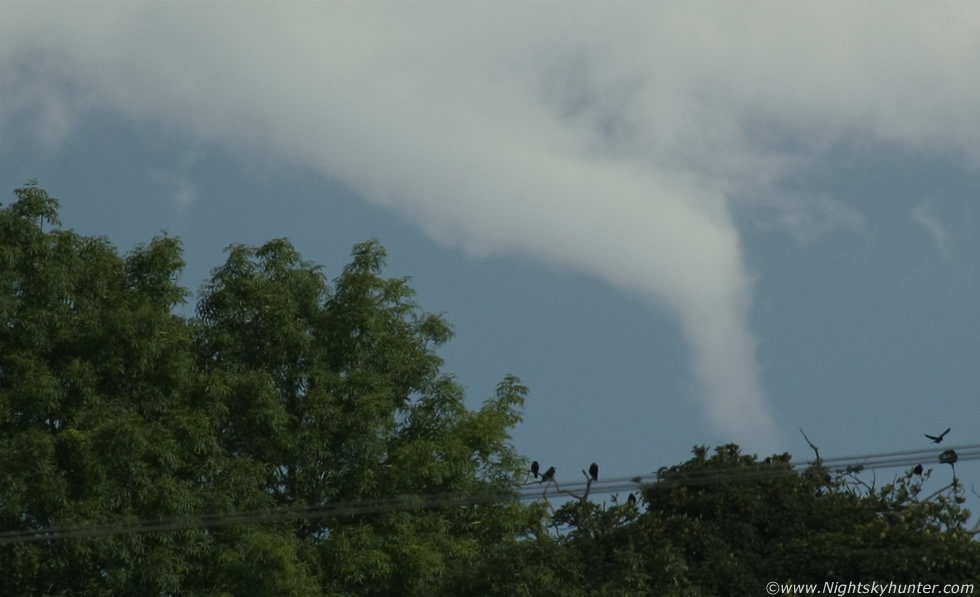
The cells where really far away so I attached the Canon 100-400mm zoom lens which was a wise decision. During the course of the next 15 min's I observed a stunning funnel cloud/possible tornado over E. Antrim some 20 miles away or more. The funnel constantly changed from an inverted bowl to a thick tube then to a lovely cone then finally into a rope. I took 100 images so I can only post a few on here despite the strong desire to add many more. These two images show the funnel's early life stage along with some of the cloud structure, you can see the funnel to the R of the tree at centre, the updraught of the parent cell towered high into the atmosphere way beyond the top of this image.
 |
The image stabilization must be very good on this lens because my hands were shaking with adrenaline as I watched the funnel close up through the viewfinder, I could see it rotating and changing shape constantly, as I watched it lowered towards the ground half a dozen times morphing from an obvious funnel shape to a subdued tuba form, funnels like to do that and you can bet that just when you think the show is over it will come back again better than ever, and that's exactly what happened.
 |
Full 400mm zoom into the heart of the action, definitely a big solid cone in there
 |
Going back out to 100mm showing updraught/flanking structure with cone funnel
 |
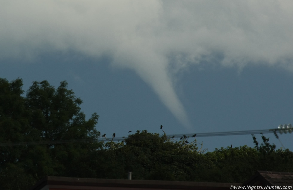
The funnel came back in style and grew larger in size as a long cone rotating over the flat plains of Antrim. Due to the cell's R to L motion I lost sight of the funnel at times behind the trees so I had to run quickly to the R over rough ground with the big lens to compensate for that motion so I could catch it between the trees, I was constantly on the move, shoot then move and repeat while trying not to shake the camera and keep my breathing steady.
 |
At 16.35 the funnel was jaw dropping!, this was taken at 400mm with the funnel some 20+ miles away so this must have been a beast. At this point I was thrilled beyond belief and shaking, I have seen many funnel clouds over the years however that feeling of excitement never fades, just like Christmas morning, it reminded me of my very first funnel catch back in July 2007 which, incidentally, was photographed from this very same location!. I was cursing myself for not finding a better foreground and also for not taking video footage as my tripod and camcorder where with me however I just hadn't the time to set them up and run around with them, it was either still images or nothing so I stand by my decision.
 |
At this point I was contemplating the possibility that this could be a tornado because the funnel was fairly close to the ground and the updraught which spawned it was powerful. The visible condensation funnel is only a small portion of the vortex, the true invisible portion is wider and longer than the actual funnel which is why you don't need to see a funnel extending all the way from cloud base to ground for it to be a legitimate tornado. If this was a tornado it would need to be confirmed by other eyewitnesses who saw it or if there was damage on the ground. If this happened over open country then there would unlikely be any evidence to confirm it so for the time being this one has a question mark over it. I was certain at the time that this funnel would have been widely seen by drivers on the roads and by people working outdoors however at the time of writing I haven't heard of another report from anywhere which is quite shocking considering how significant and obvious the funnel was in full sunlight. My guess is that the majority of potential witnesses in Antrim and Ballymena would have been under the rain core of the storm or had their view blocked by clouds from the E side of the flanking line so perhaps this is why it went unnoticed for only those to the W of the storm in the sunshine would have seen it.
 |
Crop from another 400mm image. The cloud tendrils around the funnel and under the base really captivate the rapid rotation, there was bound to have been some kind of contact on the ground from this!
 |
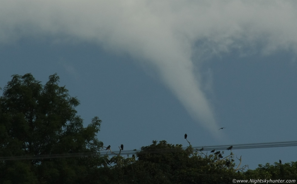
I lost it behind trees just as it bent sharply at the middle then lifted into a horizontal position which is often a sign that a funnel or tornado is about to vanish. Second's later it roped out gracefully like the neck of a Swan and was gone at 16.35.
 |
Deep crop from another image showing an almost 90 degree bend in the tube with ribs around the funnel indicating vigorous rotation.
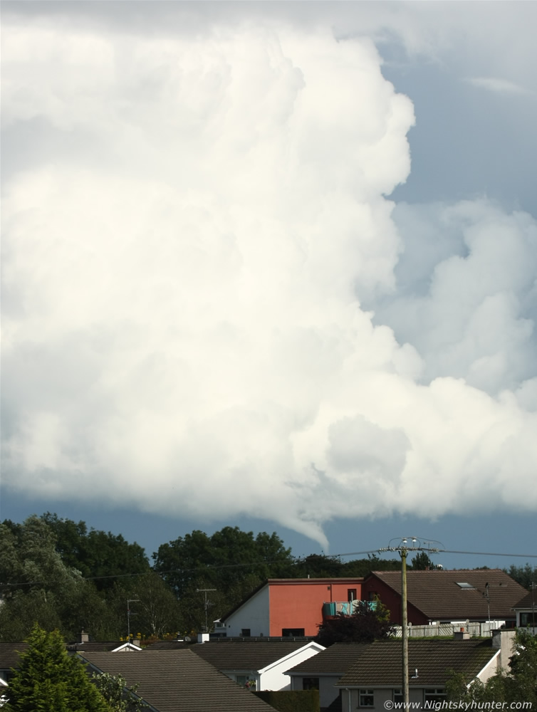 |
A very rare image in N. Ireland showing entire updraught, storm structure, and funnel/tornado all on the same frame in full sunlight.
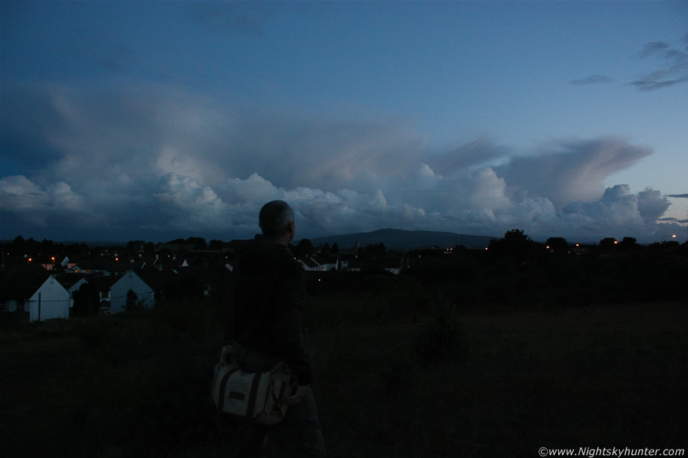 |
I spent the evening uploading images onto the computer and reporting the suspect tornado to the appropriate contacts then planned on having a relaxed evening until I got a text alert from Paul Martin asking ''can you see that mamma from Maghera?'', I grabbed the gear and walked back to the same location I was at earlier to check out the sky, blimey what a surprise, along the entire SW to S sky was a line of stunning cells with the underside of the anvils sporting mammatus and all lit from below by the setting sun into a spectacular scene, what impressed me the most was that those cells where over Omagh which is very far from Maghera and yet they were a striking sight in the sky, I thought Paul must have been getting a great show, if you check out his website Tyroneskies.com you will see images of those same cells from Omagh which are fantastic!. I messed up my own images of the sunset scene because I accidentally had my camera on fluorescent white balance while taking images of my Dog in the house earlier so I missed the best part of the show. The scene was still majestic and beautiful long after sunset with those distant towers and anvils crossing the southern skyline behind Slieve Gallion heading for the S side of the Lough all against a lovely dusk sky. This is a noisy image as I used ISO1600 which shows the grain very easily but even so you get the idea, it was fantastic watching these cells as darkness arrived accompanied by the occasional chirping from Birds settling down for the night. It was hard to believe that I was watching a possible tornado from this very spot hours earlier, it now seemed like a life time ago, nature sure was good to me this day.
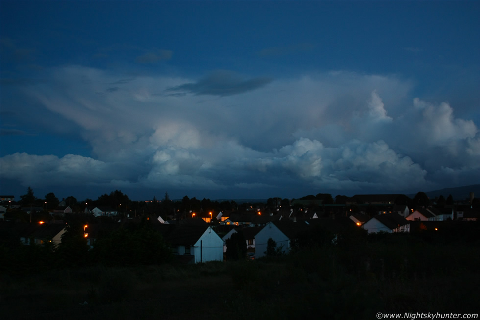 |
Advanced twilight and very low light so the camera was mounted on the tripod to shoot these massive cells, the glow from the brighter W sky illuminated a cluster of mammatus on the leading edge of the anvil. I made sure to focus on the clouds using live view and used a cable release then stopped the lens down a little for very short exposures in the hope of catching any bolts of lightning, I didn't see any but I didn't mind, just watching these cells against the twilight sky was the perfect end to a perfect day.
This video clip begins with footage of the cells in the flanking line which produced the funnel followed by still images of the funnel then back to footage of the dusk storm cells and ending with stills of the same scene which is worth seeing, the video is 8 min's long so watch it after sunset with a warm brew.
Video clip showing the severe thunderstorm cells over Co. Antrim including the back-building multicell I chased during the late afternoon, the clip is 15 min's in duration and well worth checking out for it conveys the true size of these storms along with the storm structure, I hope you enjoy both clips. Thanks very much for reading.
Martin McKenna